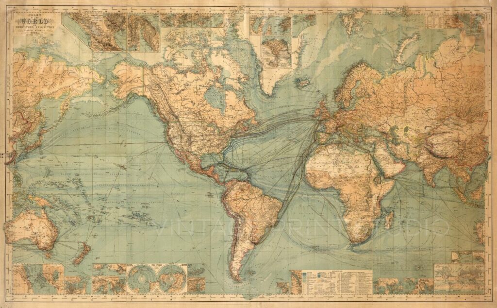
Maps have always played a crucial role in human civilization, serving as tools for exploration, navigation, and understanding the world. Vintage cartography, the study and appreciation of historical maps, is a fascinating blend of art and science. These maps not only reflect the geographical knowledge of their time but also embody the cultural and artistic styles of different eras. This article explores the rich history of vintage cartography, the techniques used in ancient mapmaking, and the enduring charm of these historical artifacts.
The Evolution of Early Maps
Ancient Maps: Pioneers of Cartography
The earliest known maps date back to prehistoric times, with rudimentary representations of landscapes found in cave paintings and carved stones. Ancient civilizations such as the Babylonians, Egyptians, and Chinese developed sophisticated mapping techniques. The Babylonians used clay tablets to depict their cities, while the Egyptians created maps to navigate the Nile and demarcate land for agriculture.
Greek and Roman Contributions
Greek scholars made significant advances in cartography. The philosopher Anaximander (c. 610–546 BCE) is credited with creating one of the first known world maps. Later, Claudius Ptolemy (c. 100–170 CE) compiled extensive geographical knowledge into his work Geographia, introducing the concept of latitude and longitude, which remains fundamental in modern cartography.
Medieval Maps: The Age of Exploration
During the Middle Ages, European maps were heavily influenced by religious and mythological beliefs. The “T-O maps,” such as the famous Hereford Mappa Mundi, depicted a world centered around Jerusalem with Europe, Asia, and Africa forming a symbolic cross. Arab cartographers like Al-Idrisi improved upon Greek knowledge, creating highly accurate maps that greatly influenced European explorers.
The Renaissance and the Golden Age of Cartography
The Age of Exploration and Mercator’s Projection
The 15th and 16th centuries marked the dawn of the Age of Exploration. European explorers, driven by the search for new trade routes, relied on increasingly accurate maps. Gerardus Mercator (1512–1594) revolutionized cartography with his famous Mercator Projection, which allowed sailors to navigate using straight-line courses, an innovation that is still widely used in nautical charts today.
Artistic Flourishes: The Role of Illustrations in Vintage Maps
Early modern maps were not just tools for navigation but also works of art. Cartographers adorned their maps with elaborate illustrations of sea monsters, compass roses, and mythological figures. The Dutch cartographers of the 17th century, such as Willem Blaeu and Johannes Janssonius, created some of the most visually stunning maps, often decorated with baroque-style embellishments.
The Printing Revolution and Mass-Produced Maps
With the advent of the printing press in the 15th century, maps became more widely available. The 16th and 17th centuries saw an explosion of atlases and travel guides, making geographical knowledge accessible to a broader audience. Maps became status symbols, often displayed in the homes of the wealthy as a testament to their worldliness and education.
The Decline of Hand-Drawn Maps and the Rise of Modern Cartography
By the 18th and 19th centuries, technological advancements led to more precise mapping techniques. The development of triangulation and later, aerial photography, paved the way for modern cartography. Despite this, vintage maps remained highly valued for their aesthetic and historical significance.
The Enduring Appeal of Vintage Cartography
Collecting and Preserving Antique Maps
Today, antique maps are treasured collectibles, sought after by historians, collectors, and enthusiasts. Museums and private collectors meticulously preserve these maps, appreciating them for their artistic beauty and historical value. Restoration techniques ensure that these fragile artifacts withstand the test of time.
Vintage Maps in Contemporary Design
The aesthetic appeal of vintage maps has found a place in modern decor. Many designers incorporate antique maps into home and office spaces, using them as wallpaper, framed artwork, or even furniture prints. The nostalgia and charm of old-world cartography provide a unique blend of sophistication and curiosity.
Digital Preservation and the Future of Historical Maps
With advancements in digital technology, many institutions have embarked on projects to digitize historical maps. Digital archives allow researchers and enthusiasts to explore ancient cartography without risking damage to original artifacts. Projects like the David Rumsey Map Collection and the Library of Congress’s map archives provide invaluable resources for studying vintage cartography.
Conclusion: A Legacy Etched in Time
Vintage cartography is more than just a study of old maps; it is a window into the past, revealing how our ancestors viewed and interpreted the world. From the crude maps of early civilizations to the intricate masterpieces of the Renaissance, each map tells a story of discovery, ambition, and artistic expression. As we continue to explore and appreciate these historical treasures, vintage cartography remains a testament to human ingenuity and curiosity, ensuring that the art and science of mapmaking are never forgotten.


